The Science of Hurricanes: Understanding Wind Speeds and Storm Surge with Hurricane Milton
Hurricanes are among the most powerful and intricate phenomena in nature, captivating scientists, meteorologists, and the general public alike. Characterized by their rotating wind patterns, intense rainfall, and significant storm surges, hurricanes pose severe risks to coastal areas. This blog post aims to delve into the science of hurricanes, specifically focusing on the wind speeds associated with these storms and the calamitous impacts of storm surge, using the recent example of Hurricane Milton.
 What is a Hurricane?
At its most basic, a hurricane is a type of tropical cyclone, which is a rapidly rotating storm system featuring a center of low atmospheric pressure, organized convection (thunderstorms), and a closed wind circulation pattern. Hurricanes primarily form over warm sea waters in tropical and subtropical regions, where the conditions allow for sustained energy exchange between the ocean and atmosphere.
The classification of hurricanes is typically done using the Saffir-Simpson Hurricane Wind Scale, which categorizes hurricanes from Category 1 to Category 5 based on their sustained wind speeds. This scale serves as a crucial tool for assessing potential damage and issuing warnings.
Hurricane Category Wind Speeds
Understanding the categories of hurricanes is essential for both preparedness and disaster response. The wind speed thresholds for each category are as follows:
- Category 1: Wind Speeds of 74-95 mph
- Category 2: Wind Speeds of 96-110 mph
- Category 3 (Major Hurricane): Wind Speeds of 111-129 mph
- Category 4 (Major Hurricane): Wind Speeds of 130-156 mph
- Category 5 (Major Hurricane): Wind Speeds of 157 mph and higher
In the case of Hurricane Milton, which was classified as a Category 5 storm shortly before making landfall, it exhibited wind speeds exceeding 157 mph. This level of intensity dramatically escalates the potential for destruction, with not only the wind impacting structures and vegetation but also the intense rainfall and storm surge contributing to flooding and additional damage.
Category 5 Hurricane Wind Speed Details
Category 5 hurricanes are extremely rare and thus require an in-depth understanding. These storms produce average sustained wind speeds of at least 157 mph; however, some extraordinary hurricanes, such as Hurricane Milton, can reach maximum sustained winds that push against recorded limits. A historical reference point includes Hurricane Patricia, which recorded the fastest sustained winds in the Western Hemisphere at 215 mph. The power carried in these winds impacts everything from the structural integrity of buildings to the aquatic ecosystems of coastal areas.
When discussing wind speeds, it’s crucial to mention that the Saffir-Simpson scale does not account for other significant factors such as storm surge and rainfall, which can exacerbate the damage significantly.
What is Storm Surge?
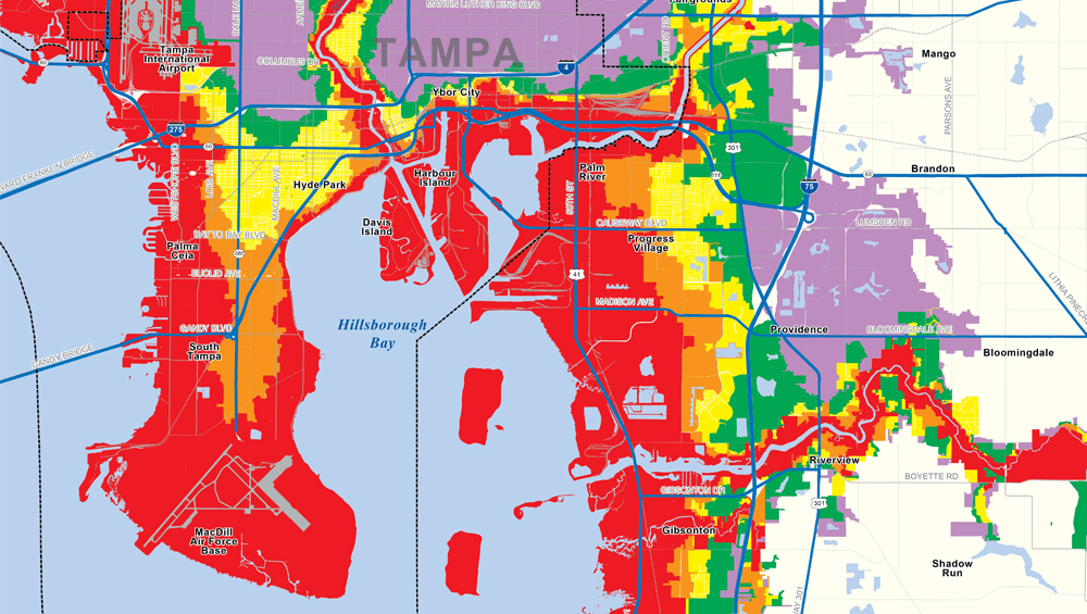
Storm surge is the abnormal rise of water generated by a storm's winds over and above the normal tidal level. It is one of the most dangerous aspects of hurricanes and often accounts for the majority of storm-related fatalities. The rise in water is caused by the combined effects of the low pressure at the storm's center and the strong winds pushing water toward the shore.
Storm surge can vary dramatically depending on the size of the storm, the speed at which it is moving, the shape of the coastline, and the angle at which the storm approaches land. For a hurricane like Milton, which brought catastrophic surge levels, water levels can rise several feet above normal tide levels, inundating coastal communities and causing widespread destruction.
Understanding the Interaction Between Wind Speeds and Storm Surge
The relationship between wind speeds and storm surge is not linear; rather, storm surge results from a complex interplay of wind direction, speed, and sea floor topography. For instance, during Hurricane Milton, its high maximum sustained winds not only whipped up formidable waves but also pushed ocean water onto land with great force, worsening flooding conditions.
The combination of Milton's wind speeds and its storm surge led to devastating impacts that prompted immediate evacuation orders and extensive disaster response efforts. A storm categorized as Category 5 not only signifies intense winds; it indicates an overall threat level that encompasses potential flood damage, infrastructure failure, and severe loss of life, particularly in vulnerable coastal zones.
Lowest Pressure Hurricane: The Case of the 900 mb Hurricane
Another critical concept worth exploring in the discussion of hurricanes is atmospheric pressure. Hurricane strength is inversely related to the central pressure of the storm. Lower pressure indicates more intense storms. For example, a hurricane with a pressure reading of 900 millibars (mb) would be classified as an unprecedented atmospheric event. The lowest pressure ever recorded from a hurricane in the Atlantic basin remains Hurricane Wilma in 2005, which peaked at 882 mb.
Hurricane Milton, although no record-holder in pressure, still exhibited significant pressure drops as it intensified, contributing further to its classification as a major hurricane. The correlation between low pressure and wind speeds highlights the dynamic conditions necessary for hurricane formation and intensification.
Preparing for Future Hurricanes
As climate change continues to impact ocean temperatures and atmospheric conditions, the potential for more intense storms like Hurricane Milton remains a concern for coastal communities. Understanding the science behind hurricanes, encompassing wind speeds, storm surge, and atmospheric pressure, is crucial for implementing effective disaster preparedness strategies.
Preparation includes robust early warning systems, building codes that can withstand extreme wind events, effective evacuation plans, and community education on the dangers of storm surges. Increased research and investment in meteorological technologies can further enhance predictive capabilities and responses as storms develop and approach landfall.
Conclusion
The science of hurricanes is multifaceted, involving detailed analyses of wind speeds, storm surge, and atmospheric pressure. Hurricane Milton serves as a recent reminder of the destructive power these storms can unleash. As communities grapple with the realities of climate change and the increasing frequency of major hurricanes, it becomes paramount for both individuals and policymakers to understand the science behind these storms. Through comprehensive education and preparedness planning, vulnerable regions can effectively mitigate risks and save lives in times of crisis. Understanding what a hurricane truly entails is not just an academic query but a necessary component of modern disaster management.